Wind River Range (WY) Backpacking – June 2018
Wind River Range – June 2018
29
JUNE, 2018
Since starting out on my backpacking adventures in 2010 a hike in the Wind River Range of Wyoming had been at the very top of my dream destinations. But I was intimidated by the Winds. I didn’t know anything about hiking there, or the logistics required for such a trip. But that changed when I started hiking with Travis in 2016. He was a veteran of many Winds trips, and knew ‘the ropes.’ During our 2017 Smokies hike Travis suggested a 2018 hike in the Wind River Range. I jumped at the opportunity. We ended up going in early July 2018. The trip didn’t go as planned, and we ended up experiencing biblical-level swarms of mosquitos, but it still ended up being a great hike.
Pre-Trip Preparations


At one point, I thought about driving to Pinedale from Indiana to save some money. But I changed my mind when I realized Pinedale is in the far northwest corner of Wyoming. That’s a 24-hour drive from Indiana. Flying was the only logical travel choice. But that meant I couldn’t take my two Labradors, Jaden and Bailey, as initially hoped. Christian was living in Boulder, so I planned to fly to Denver. I’d meet Travis at the airport (flying from Cincinnati), rent a car, and pick up Christian. We would all make the seven-hour drive across Wyoming to Pinedale. All of our gear was in Indiana so I packed up two big green duffel bags with our backpacks. The hike checklist was finished, including bug nets for the first time.
Travel to Pinedale
Everything proceeded smoothly until the final approach in Denver. I was fascinated watching another Southwest 737 landing on a parallel runway not far away. Just as the asphalt of our runway came into view, seconds from touchdown, the pilot applied full power. The plane went skyward again. Moments later, they announced, ‘we need to try that again!’ Hmm… Unusual, but… ok. Our second landing went better, and I soon had both VERY heavy duffel bags. I rented a luggage cart to ease the burden. Travis also arrived on time. We picked up the rental car and headed for Boulder to get Christian. After a quick tour of Christian’s apartment, the three of us were driving across Wyoming’s majestic wide open spaces.


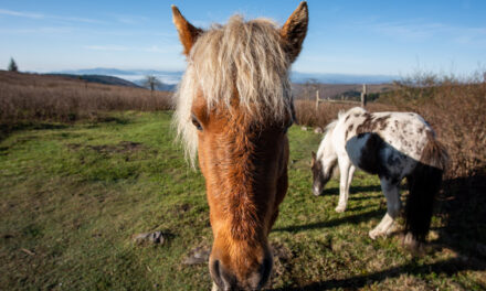
First view of the Wind River Range while traveling north on US-191 south of Pinedale
Where is Pinedale, Wyoming?

Arrival in Pinedale and the Log Cabin Motel


One of the more essential nuggets of Wind River Range wisdom Travis imparted to us was staying at the Log Cabin Motel. Pinedale is a small town with few lodging options. Even so, the Log Cabin likely isn’t at the top of Pinedale lodging searches because it’s not a typical generic chain hotel. The Log Cabin is a local ‘Mom and Pop’ place that has history and character. Though it’s called a ‘motel,’ it is a collection of 14 small cabins. Magnolia Street is in front of the cabins, one block north of the main drag in Pinedale. The location is perfect, within walking distance of everything. We got settled into our two-bedroom cabin, savored our first ‘porch time,’ and then headed to downtown Pinedale to visit The Great Outdoor Shop outfitters.

Log Cabin Motel – Pinedale, Wyoming
“Absolutely charming and cozy cabins with lots of history, and a place you must stay if you are visiting Pinedale.” – Log Cabin Motel Guest Review
Great Outdoor Shop
The Great Outdoor Shop outfitter is located in the center of Pinedale. They have a great selection of gear you might need for your hike, and the staff there provides essential information for hikes in the Winds. They have all spent countless hours on every trail you’ll be hiking in the Wind River Range. Even if you have no last-minute gear needs, if you plan to hike in the Winds, the outfitter is a mandatory stop before your hike. Trust me! Our pre-trip plan died about 5 minutes after we entered the shop. The Shop Gurus told us our plan to hike to Island Lake wasn’t feasible because the trail was under three feet of water in some spots. They suggested an alternate hike from the Big Sandy Trailhead, which we immediately adopted.


Great Outdoor Shop – Pinedale, Wyoming
“Such a great outfitter shop – I stop here before every big backpacking trip to stock up on last minute gear and ask the employees questions about routes, trail info, etc. Truly an invaluable resource!” – Great Outdoor Shop Review
Wind River Brewing Company and porch time


In addition to the Log Cabin Motel and the Great Outdoor Shop, Travis had one more piece of Winds wisdom to pass along to us. The Wind River Brewing Company! Conveniently, it is located right across the street from The Great Outdoor Shop. We sat indoors because it was chilly, but when the weather is warm, they have outdoor seating on both levels. They offer an excellent selection of house-brewed craft beers and classics from all over the Mountain West. Their food is typical bar-type fare but its tasty and satisfying. After dinner, we headed back to our cabin to spend time enjoying the porch. Travis shared hiking information from the Wind River Range trail guide, and we finalized our revised plan for the hike.

Porch Time at the Log Cabin motel – Travis leading final planning the night before the hike
YouTube Video – Night in Pinedale and porch time before hike
2018 Wind River Range Hike Plans
Three separate plans came into play for our 2018 Winds trip. Going into the trip, we planned to leave out of the Elkhart Park Trailhead northeast of Pinedale and hike to Island Lake and the Titcomb Basin. That is the hike Carl and I did during our 2019 Wind River Range hike and the same hike a large crew did on the 2021 Wind River Range hike. Unfortunately, when we arrived in Pinedale the knowledgeable gurus at The Great Outdoor Shop outfitters told us portions of the trail were still under several feet of water from recent snow melt. So instead, they suggested we make a trip out of the Big Sandy Trailhead south of Pinedale. ‘Plan B’ was the Cirque of the Towers, but that didn’t work due to snow on Jackass Pass. Finally, we did ‘Plan C’ – a hike to Dad’s and Marms Lake.

“We don’t stop hiking because we grow old – we grow old because we stop hiking.” – Finis Mitchell
First day hiking in the Wind River Range 2018
Breakfast at the Heart and Soul Cafe
Our first morning hiking in the Wind River Range dawned clear, cold, and beautiful. Sunshine and a complete lack of humidity combined to create clarity to the scenes and vibrance to colors that I have only witnessed in the mountains out west. Even on the driest days, Midwest humidity dampens nature’s saturation as if a matte finish has been applied to what the human eye sees. Travis had one more jewel of Wind River wisdom to bestow upon us. Breakfast at the Heart and Soul Cafe on the main street in Pinedale. It was a short walk from the Log Cabin. One of the most cherished treats before backpacking is a tasty pre-hike breakfast. I start every trip with breakfast at a local Mom-and-Pop place if possible. The Heart and Soul Cafe satisfied that pre-hike ritual perfectly.


Heart and Soul Cafe – Pinedale, Wyoming
First Adventure of the Trip – Finding the Big Sandy Trailhead


One downside to our change of plans was starting at the Big Sandy Trailhead. We would have started at the Elkhart Park Trailhead for the original hike we had planned to Island Lake. Elkhart is much closer to Pinedale. You drive straight out of town to the east on Pine Street, then up the mountain for 20 minutes, and you’re there. Not so for Big Sandy. The Big Sandy Trailhead is an hour’s drive southeast of Pinedale on unmarked dirt roads with many unmarked turns. The drive is through open range for cattle grazing, so dodging an occasional cow (or an entire herd) is not un-herd of. 🙂 Our porch time studying the guide paid off, and after only a couple missed turns we arrived at the Big Sandy Trailhead.
YouTube Video – First Morning and Drive to Big Sandy Trailhead
Beautiful start to the hike on the Fremont Trail
There haven’t been many better days for hiking. ‘Blue skies’ doesn’t come close to describing how intensely clear and blue that sky was. Clouds were non-existent, and the forecast for our hike was for good weather the entire four days. One downside made its presence known as soon as we emerged from the car. Mosquitoes! As we were prepping our gear at the trailhead, they slowly accumulated around each of us. It was an ominous sign of what was to come. But once we got moving, they didn’t bother us. The hike started on flat, smooth Fremont Trail alongside Big Sandy Creek. It was pleasant and fast. After one mile, we reached the intersection with the Meeks Lake Trail. We turned left and went uphill. The trail to the right continued flat along the creek, and then up to Cirque of the Towers.


Into the Woods and Past Meek’s Lake


Once we turned left on the Meek’s Lake Trail, we headed uphill into the woods. Pine trees killed by the voracious pine beetle appeared in increasing numbers, though nothing like the clear-cut effect in other areas I’ve seen in the mountain west. Occasionally we would catch glimpses of Laturio Mountain in the distance. Our hike would take us right along the western base of that range. Humidity was non-existent, and when the sun would find us, you could feel yourself slowly being turned into hiker jerky. Pleasant pine scent permeated the air and gave the hiking a decidedly ‘out west’ ambiance. Trees blocked the wind allowing the mosquitoes a free pass on swarming us. The ‘mozzies’ provided plenty of motivation to keep moving.

Christian in the woods past Meek’s Lake, looking towards Laturio Mountain
Fish Creek Park
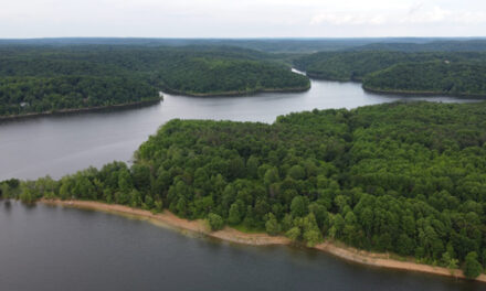
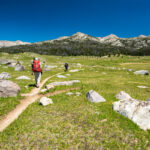
During our Rocky Mountain car camping trips with the kids, I learned that a ‘park’ in the Rockies is an open, meadow-type space high up in the mountains. Some of them, like Taylor Park near Crested Butte, are huge (10 square miles). A highlight of our Wind River Range hike was crossing Fish Creek Park in both directions. Fish Creek Park was modest by Rocky Mountain ‘Park’ standards, about one mile by a half-mile in size, but it was still awesome. The air was so clear and crisp that distances appeared compressed. It was a mile to hike across, but it looked like you could reach out and touch Bunion Mountain on the far side. Each step forward was on the Continental Divide Trail at this point in our Winds hike. We were in awe that the trail we were hiking spanned 3000+ miles from Mexico to Canada.


Crossing Fish Creek Park with Bunion Peak and Mount Geikie in background
Dad’s Lake – Unplanned first Wind River Range campsite
Our original plan was to camp the first night at Marm’s Lake, two miles past Dad’s Lake. But when we came over the final rise and got our first glimpse of Dad’s Lake, we started tossing around the idea of staying there for the night. We walked to a slight rise a short distance to the left of the Continental Divide Trail to get a better look at the lake. There we found the ‘perfect’ campsite. The main reason it was perfect would have typically disqualified it from consideration. The camp was entirely exposed to a steady 15 MPH breeze. In that situation, it was exactly what we were looking for. Mosquitoes were swarming mercilessly whenever there was no wind. The constant wind and smoke from the campfire kept the little buggers at bay.


Travis taking in the scene at Dad’s Lake from our windy, exposed campsite
Buggy Night at Dad’s Lake Campsite


We had a birds-eye view of the sunset from the top of our rise at the south end of Dad’s Lake. A warming fire and steady breeze kept the mosquitoes at an annoying level rather than insanity-inducing. Hanging the food bag in the woods up the hill gave us a taste of how bad the mozzies could get when given free rein. You didn’t dare open your mouth because you were guaranteed an instant mouthful. This magical place was all ours. Only one other hiker had passed by the entire day. Despite our camp being located just off the famous Continental Divide Trail, this was hiking in the Winds in late June. It was effectively still winter. The throngs that would be here in August were still at home planning their later-season hikes.

Dad’s Lake campsite at sunset
YouTube Video – Night at Dad’s Lake
Second day hiking in the Wind River Range 2018
Beautiful (and buggy) morning at Dad’s Lake
Another perfect morning greeted us at Dad’s Lake for our second day of hiking in the Winds. The breeze was gone, as was our campfire, so the mosquitoes were out in force. And I mean in FORCE! Fortunately, we were learning that bug nets on your head, though intrusive and annoying, were highly effective. So too was the permethrin we had sprayed on our clothes before the hike. You still got swarmed with literal clouds of mozzies, but bites were kept to a minimum. I shudder to say we started getting used to it. The bug strategy was: bug net on your head, permethrin-coated clothes covering as much skin as possible, and DEET on any exposed skin. It worked! After a quick breakfast, we started the short hike north to Marm’s Lake.


Author having breakfast with ‘friends’ at Dad’s Lake
“A mountain is the best medicine for a troubled mind. Seldom does man ponder his own insignificance. Only when he tramps the mountains alone, communing with nature, observing other insignificant creatures about him, to come and go as he will, does he awaken to his own short-lived presence on earth.” – Finis Mitchell
Dad’s Lake to Marm’s Lake


It is less than two miles from Dad’s Lake to Marm’s Lake. Our initial thought for this Wind River ‘plan C’ hike was to spend the first night at Marm’s Lake and the second night at Shadow Lake, four miles beyond Marm’s. Somewhere amidst all the hiking plan changes, we decided our Winds hike would be about enjoyment, views, and nice camping spots rather than pounding miles. That led to our decision to cut it short on day one and stay at Dad’s Lake. Travis decided to start our short day with some fishing from the shore. He caught one small trout, but he put the little guy back in the lake. Our hike was so short that we could still see Dad’s Lake in the distance as we climbed the last hill before Marm’s Lake. Crossing Donald Creek shortly after the hike started provided the day’s only real ‘excitement.


Christian getting his feet wet crossing Donald Creek enroute to Marm’s Lake
YouTube Video – Dad’s Lake to Marm’s Lake
Campsite at Marm’s Lake
Shortly after hitting the summit of the climb up Dad’s Creek, we came out on a large open field overlooking Marm’s Lake. A steady wind was blowing from the top of the hill towards the lake, and there were stone fire rings dotting the area. It had taken us only a short time to find the perfect camping spot for our night at Marm’s Lake. In many ways, it was similar to our campsite at Dad’s. Our hike for the day had been less than an hour, so we arrived very early. Christian and I decided to take a day hike toward Shadow Lake after setting up camp. Travis was suffering from knee pain, so he decided to relax at camp and fish in the lake. It didn’t take long to answer the question, “Will the mosquitoes be bad?” – they were even worse than at Dad’s Lake.


Campsite at Marm’s Lake – Christian’s hammock was in the woods
Day Hike to Shadow Lake
North on the CDT to Unnamed Lake
While Travis tried his luck fishing from the shore near our camp, Christian and I headed north on the Continental Divide Trail. We had decided against going all the way to Shadow Lake. It was five miles in each direction, and even though our day had been short thus far, that was more than we wanted to take on. Instead, our objective was a small, unnamed lake a mile north of the far shore of Marm’s Lake. Clouds had started to roll in though they weren’t ominous. Our unnamed lake turned out to be more of a pond. It was pretty, but not much to get excited about. The rise above the pond did offer an outstanding view of the mountain range in the distance. Wispy, cirrus clouds made for an interesting sky that had the look of multiple jet contrails streaking across.


Christian at a tarn near Unnamed Lake with Mount Geikie and Mount Washakie in background
Bones on the trail returning to Marm’s Lake


Along the side of the Continental Divide Trail, on our way back to Marm’s Lake, we came upon the bones of a large animal. The bones were bleached white and strewn about over a few meter area. Antlers indicated that it was likely the remains of a deer, but that was anybody’s guess. The clouds that had built up and caused some concern had remained the benign puffy cumulus and cirrus type. The scene was gorgeous as we returned to the north shore of Marm’s Lake. The backside of the mountains that formed the Cirque of Towers dominated the horizon to the east. We could see Travis and our camp on the far shore. Another hiker appeared near Travis, setting up his tent. It seemed we would have some company at Marm’s Lake.

North shore of Marm’s Lake looking south – Continental Divide Trail on right (west) shore
Battling Mosquitoes
Most campers can recall a time when sitting around a campfire trying to dodge the smoke as it somehow blew in their face regardless of where they sat. Our night at Marm’s Lake involved just the opposite. We all tried to get downwind, directly in the path of the worst of the smoke. Pine boughs were added to the fire occasionally to generate even more smoke. Even the healthy breeze and heavy smoke did not dissuade the mosquitoes. They were even ‘thicker’ than we had experienced at Dad’s Lake. Our neighbor had set his tent up along the lakeshore, a few hundred meters down the hill from our camp. At one point, he peeled off his clothes and went swimming. When he got out of the water, his mosquito-evading antics gave us a good chuckle.


Enjoying a wind-induced mosquito break in camp at Marm’s Lake
Night at Marm’s Lake
Our night at Marm’s Lake ended up being the last night of our hike. Initially, we had planned to retrace our steps on the Continental Divide Trail almost to the trailhead and then make a left turn on the Diamond Lake Trail towards the Cirque of the Towers. We had planned to camp at either Diamond Lake or, more likely, Big Sandy Lake. The mosquitoes made us rethink that plan. While sitting in the smoke of the fire, we decided to forego the additional night in the backcountry and head directly back to the trailhead the following day. From there, we planned to continue our ‘hike’ at the Melvin Brewery in Alpine, Wyoming. With our consensus on ‘plan D’ finalized we enjoyed the sun setting over Marm’s Lake.


YouTube Video – Battling Mosquitoes at Marm’s Lake
Third day hiking in the Wind River Range 2018
Morning at Marm’s Lake and final group pictures


With the decision to shorten the trip and head straight back to the car, there was a newfound sense of excitement in the morning. The promise of mosquito-free adventure lightened the mood as we drank coffee and ate breakfast before hiking. It was yet another perfect morning, and we realized that even though our ‘bug luck’ had been poor, our weather luck had been outstanding. Not even mosquitos stuck on my toothpaste or the nightmarish experience of doing our morning bathroom ‘duty’ in the woods could dampen our spirits. The mosquitoes had been constantly ‘bad,’ but nothing compared to the cloud of ravenous skeeters feasting on exposed sensitive skin in prime-time jungle habitat with no wind or smoke.
Marm’s Lake to the Big Sandy Trailhead
After some last group pictures at Marm’s Lake, we headed south on the CDT to retrace all the steps we had taken over the first two days. Even so, it wouldn’t be excessive miles back to the Big Sandy Trailhead – seven miles. Clouds had moved in, as had warmer temperatures, but there was no threat of rain. Our camp at Marm’s Lake was at 9,900 feet of elevation. The Big Sandy Trailhead was 9,080, so the hiking was all downhill to the car. It was a gentle, 100-foot-per-mile grade, so the only impact on the hike was to speed up our pace slightly. As we passed Dad’s Lake, we briefly stopped at our first night’s camp to take a group picture. Crossing Fish Creek Park, our pace was a brisk four MPH. Two hours after we left our camp at Marm’s Lake, we arrived at Big Sandy Trailhead.


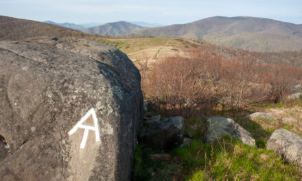
Continental Divide Trail sign in Fish Creek Park
Conclusion – Wind River Range, June 2018
Certain ‘special’ hikes during my backpacking career have ‘set the bar’ for various trip characteristics. The 2020 Adirondack High Peaks Wilderness hike established the ‘record’ for the most physically demanding hike. Biblical swarms of ticks defined the 2019 Big South Fork hike. Our 2015 Four Pass Loop hike excelled at high-altitude hiking and rain. And similarly, the 2018 Wind River Range trip set the bar for mosquitoes. Whenever we’ve run into bad mosquitoes on trips after the 2018 Winds trip, like the 2019 Yellowstone hike, one of us would say, “The mozzies aren’t nearly as bad as the Winds.” End of discussion! But the Winds wasn’t all about skeeters. The scenery and views blew us away. Add the permit-free hiking, and the Winds quickly became one of my favorite go-to western destinations. In many ways, the trip didn’t go as planned, but I’ll always fondly remember my first Winds hike.

Group shot at Dad’s Lake